
Why Utah Might Be the Most Geologically Diverse State in America
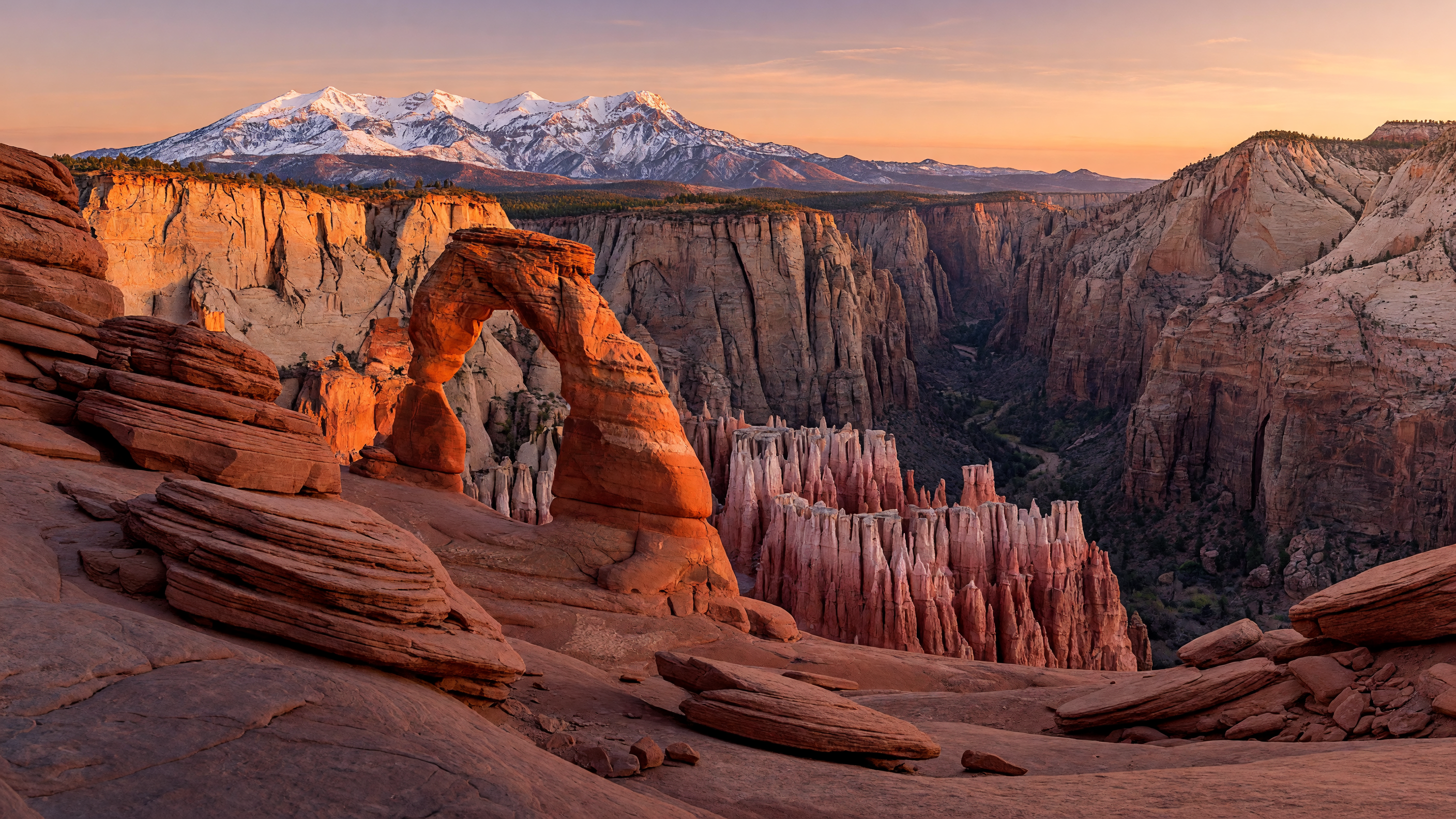
If you have ever driven across Utah — really driven, from the snow-capped Wasatch peaks down through the red rock canyons of the south and out onto the blinding white salt flats to the west — you already know something that geologists have been saying for decades: few places on the planet pack this much geological variety into a single state. Utah is a living textbook of Earth science, where 180-million-year-old sand dunes stand next to glaciers, and an ancient inland sea left behind a salt flat that rivals anything in the Sahara.
Whether you are a lifelong Utahn, a first-time visitor, or someone considering a move to the Wasatch Front, these ten geological facts will change the way you look at the Beehive State.
1. Five National Parks — The Mighty 5
Utah is home to five national parks — Zion, Bryce Canyon, Arches, Canyonlands, and Capitol Reef — collectively known as the "Mighty 5." Each park showcases a dramatically different geological story. Zion's towering Navajo Sandstone cliffs rise over 2,000 feet from the canyon floor. Bryce Canyon is not technically a canyon at all but a collection of amphitheaters filled with hoodoos — spire-shaped rock formations sculpted by frost-wedging over millions of years. Arches National Park contains the world's highest concentration of natural stone arches, including the iconic Delicate Arch. Canyonlands reveals the raw power of the Colorado and Green Rivers as they carved deep into layered sedimentary rock. And Capitol Reef preserves the Waterpocket Fold, a 100-mile wrinkle in the Earth's crust that geologists call a monocline.
For anyone living along the Sandy or Draper corridors, these parks are all reachable on a long weekend — a remarkable advantage that few other states can match. The diversity alone makes Utah one of the premier outdoor recreation destinations in the country.
2. Alpine Peaks, Deserts, Canyons, Forests, Salt Flats, and High Plateaus — All in One State
Few places on Earth pack so many different landscapes into one state. Utah contains alpine mountains, red rock deserts, deep canyons, dense forests, expansive salt flats, sandstone arches, and high plateaus — all within its 84,899 square miles. Drive three hours in almost any direction and the terrain changes completely. You can ski powder at Alta or Snowbird in the morning and stand in the middle of a desert by lunchtime. The transition from the Wasatch Range, which tops out above 12,000 feet, to the Basin and Range province of western Utah happens in barely an hour of driving.
This geological variety is not just beautiful — it directly shapes the lifestyle, weather, and real estate market across the state. Communities along the Wasatch Front benefit from mountain snowfall that feeds reservoirs, desert sunshine that extends the outdoor recreation season, and canyon geography that creates microclimates as diverse as the terrain itself.
3. The Great Salt Lake Is the Largest Saltwater Lake in the Western Hemisphere
The Great Salt Lake covers roughly 1,700 square miles at its average level — larger than the state of Delaware — making it the largest saltwater lake in the Western Hemisphere and one of the most saline major bodies of water on Earth. The lake's salinity averages around 12–15%, which is four to five times saltier than the ocean. That salinity means you can float effortlessly in its waters, much like floating in the Dead Sea, though on a much more modest scale.
The Great Salt Lake is a remnant of the ancient Lake Bonneville, a massive freshwater body that once covered much of western Utah during the Pleistocene epoch. As the climate warmed and Lake Bonneville receded, it left behind the Great Salt Lake, the Bonneville Salt Flats, and dozens of smaller salt lakes across the region. The lake's North Arm is dramatically pink due to halophilic bacteria and brine shrimp, creating a striking visual contrast with the blue-grey waters of the South Arm.
4. More Than 2,000 Natural Stone Arches
Utah contains more than 2,000 natural stone arches, with the vast majority found inside Arches National Park near Moab. That makes it the single highest concentration of natural arches anywhere on Earth. The arches formed in Entrada Sandstone, a rock layer deposited during the Jurassic period roughly 150 million years ago. Water seeps into cracks in the sandstone, freezes and expands, gradually widening the fractures until only a thin fin of rock remains. Wind and gravity do the rest, sculpting the fin into an arch.
The park's most famous arches — Landscape Arch, Double Arch, Balanced Rock, and the iconic Delicate Arch — each represent a different stage in the geological life cycle of an arch. Landscape Arch, with a span of 290 feet, is one of the longest natural stone arches in the world. Geologists estimate that most of the arches in the park will eventually collapse, making every visit a glimpse at a landscape in transition.
5. The Uinta Mountains Run East to West
Nearly every major mountain range in North America runs north to south — the Rockies, the Sierras, the Cascades, the Appalachians. The Uinta Mountains are the notable exception. Running approximately 150 miles east to west across northeastern Utah and into Wyoming, the Uintas are the longest mountain range in the United States with an east-west orientation. The range contains more than 40 peaks above 13,000 feet, and its high alpine basins hold hundreds of pristine glacial lakes.
The Uintas' unusual orientation is the result of ancient tectonic forces. Most of the Rocky Mountains were uplifted by compressional forces pushing from the west, but the Uintas were shaped by a different set of stresses that bent the rock layers into an east-west orientation. The range is also notable for being the highest point in the contiguous United States between the Front Range of Colorado and the Sierra Nevada in California. For hikers and anglers along the Wasatch Front, the Uintas are less than two hours from Lehi and Saratoga Springs, offering a true wilderness escape that feels a world away from the valley.
6. Mountains Exceeding 13,000 Feet — Kings Peak at 13,528 Feet
Utah has mountains exceeding 13,000 feet, and Kings Peak in the Uinta Range rises to 13,528 feet, making it the state's highest point. The summit is a broad, rocky dome that requires a roughly 28-mile round-trip backpack to reach via the Henrys Fork Trail. Unlike many state high points that involve technical climbing, Kings Peak is a non-technical hike — but the distance, elevation, and remote setting make it a serious undertaking that typically takes two to three days.
Beyond Kings Peak, Utah has more than 50 peaks above 13,000 feet, almost all concentrated in the Uinta Mountains and the La Sal Range near Moab. The proximity of these alpine environments to the desert landscapes below is part of what makes Utah so geologically extraordinary. You can leave a trailhead at 8,000 feet in the morning and stand on a summit above 13,000 feet by afternoon, traversing through multiple ecological zones along the way. If you are exploring the outdoor lifestyle along the Wasatch Front, the state's high peaks are one of many reasons Utah stands apart — see our golf guide and lake recreation guide for more on the state's year-round activities.
7. Some of the World's Largest Exposed Sandstone Formations
Some of the largest exposed sandstone formations on Earth are found in Utah, formed from ancient deserts that blanketed the region over 180 million years ago. The Navajo Sandstone — the dominant rock layer in Zion National Park, much of southern Utah, and parts of the Wasatch Front — originated as a vast erg, or sand sea, during the early Jurassic period. This desert was comparable in scale to the modern Sahara, with sand dunes reaching heights of several hundred feet.
Over millions of years, the dunes were buried under additional sediment, compressed, and cemented into stone through a process called lithification. The resulting sandstone preserves the original cross-bedding patterns of the ancient dunes, meaning you can literally read the direction of prehistoric winds in the rock face. The Entrada Sandstone that forms Arches National Park's famous features follows a similar origin story, deposited in a tidal flat environment along the edge of that ancient desert system. These formations are not just geological curiosities — they are the visual identity of Utah's landscape and a major draw for visitors and residents alike.
8. Utah's Famous Red Rocks Were Once Giant Sand Dunes
Those iconic red and orange rock formations that define southern Utah's scenery — the ones you see on every Utah tourism poster — started life as giant sand dunes. The iron oxide minerals coating the individual sand grains give the rock its distinctive red color, but the original dunes themselves were likely a more muted tan or white. Over hundreds of millions of years, the iron in the rock oxidized — essentially rusted — turning the formations into the vivid reds, oranges, and pinks that make places like Zion and Bryce Canyon so visually striking.
Wind and water erosion have spent the last several million years sculpting these hardened dunes into the shapes we recognize today. The process is ongoing: flash floods, freeze-thaw cycles, and wind abrasion continue to reshape Utah's red rock country every day. This is why slot canyons — those narrow, winding passages through sandstone — are so common in southern Utah. Water finds the weakest points in the rock and carves deeper with every flash flood, creating the surreal, wave-like formations at places like Antelope Canyon and Zion's Narrows.
9. The Bonneville Salt Flats Were Once Covered by an Ancient Lake Larger Than Lake Michigan
The Bonneville Salt Flats near the Nevada border are one of the most otherworldly landscapes in North America — a vast, flat expanse of white salt crust stretching across roughly 300 square miles. But this stark environment hides an extraordinary history. The salt flats are the floor of Ancient Lake Bonneville, a massive freshwater lake that covered approximately 20,000 square miles of western Utah during the late Pleistocene epoch, roughly 32,000 to 14,500 years ago. At its peak, Lake Bonneville was larger than modern Lake Michigan and up to 1,000 feet deep.
As the climate warmed at the end of the Ice Age, Lake Bonneville gradually evaporated, leaving behind the Great Salt Lake, the Bonneville Salt Flats, and the distinctive "benches" — horizontal lines visible on mountains throughout the Great Basin that mark the ancient shoreline levels. The most famous of these is the Bonneville Shoreline, which is clearly visible on the foothills along the Wasatch Front from Alpine to Sandy. If you live along the Wasatch Front, you are literally looking at the ancient beach of a lake that vanished thousands of years ago.
10. Four Ecosystems in a Single Day
Perhaps the most remarkable thing about Utah's geological diversity is how accessible it all is. You can realistically experience four distinct ecosystems in a single day of driving: alpine forests, mountain meadows, red-rock canyons, and desert landscapes — all within a few hours of each other. Start the morning on a forested trail in the Wasatch Mountains above Sandy, where Engelmann spruce and subalpine fir tower over wildflower meadows. By midday, descend through the foothills and drive south and west across the Salt Lake Valley. By early afternoon, you can be standing among the sandstone fins and arches near Moab or gazing down into the red canyons of Capitol Reef. Finish the day watching the sunset paint the desert landscape in gold and crimson from a viewpoint at Dead Horse Point State Park.
This kind of ecological diversity within a single day's drive is vanishingly rare. Most states offer one or two dominant landscape types; Utah offers an entire spectrum. It is one of the underappreciated reasons that so many people are choosing to move to Utah — the lifestyle here is not just about proximity to a single outdoor activity, it is about proximity to an extraordinary variety of them.
The Bottom Line: Utah Is a Geological Wonder
From the 180-million-year-old sand dunes of Zion to the 32,000-year-old salt crust of Bonneville, from 13,528-foot Kings Peak to the depths of the Great Salt Lake, Utah's geological story is one of the richest and most varied of any place on Earth. These ten facts barely scratch the surface. The state's geology is not just scenery — it is the foundation of the outdoor lifestyle, the water supply, the economy, and the quality of life that draws people here from around the world.
If you are exploring what it would be like to live in a place where you can hike through ancient sand dunes before dinner, Adam and Natalie Stark would love to help. As local real estate experts with deep knowledge of the Wasatch Front, they can help you find the community that puts you closest to the landscapes you love. Explore our community guides to start your journey.
Data sourced from a community post found on Facebook.
Ready to make Utah your home?
From the mountains to the desert, Utah's landscapes are calling. Let Adam and Natalie Stark help you find the perfect community along the Wasatch Front.
Talk to an ExpertRelated Articles
Best Ski Resorts Near Salt Lake City
Alta, Snowbird, Brighton, Park City, and more
Utah Lake Life: Water Sports & Recreation
Bear Lake, Lake Powell, and every lake in between
Ultimate Summer Guide 2026
Lakes, trails, festivals, and more along the Wasatch Front
Explore Wasatch Front Communities
Daybreak, Sandy, Draper, Lehi, and more